
Kajian Geologi Bawah Permukaan Daerah Geotermal Bongongoayu, Kecamatan Boliyohuto, Kabupaten Gorontalo, Provinsi Gorontalo
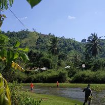
Kegiatan lapangan (sumber: Lia Elviyanti).
Daerah penelitian secara administratif berada di Kecamatan Boliyohuto, Kabupaten Gorontalo, secara fisiografi daerah penelitian berada di lembah paguyaman yang didominasi oleh batuan gunungapi dan endapan danau. Penelitian ini bertujuan untuk mengetahui geologi bawah permukaan daerah Bongonggoayu. Metode yang digunakan dalam penelitian ini menggunakan geolistrik konfigurasi Wenner-Sclumberger. Hasil penelitian geologi bawah permukaan daerah penelitian menggunakan geolistrik Wenner-Schlumberger terbagi atas 4 lintasan berdasarkan pengolahan Res2dinv dan rockword terdapat beberapa lapisan litologi berdasarkan penampang 2D bawah permukaan dimana didominasi oleh lapisan kelompok batupasir, lempung dan pasir kerikil. Kemudian terdapat anomali yang kemungkinan besar pada anomali ini terdapat pengaruh struktur dengan arah barat laut-Tenggara pada lintasan 1 dan lintasan 4.
Elviyanti, L., Maryati, S., & Manyoe, I. N. (2022). Kajian Geologi Bawah Permukaan Daerah Geotermal Bongongoayu, Kecamatan Boliyohuto, Kabupaten Gorontalo, Provinsi Gorontalo. JRST (Jurnal Riset Sains dan Teknologi), 6(2), 125-130.
Mass Wasting Mechanism of Gorontalo Outer Ring Road (GORR) in Padengo, Gorontalo
One of the things that triggered the unrealized government project, namely Gorontalo Outer Ring Road or GORR, is the number of landslide points scattered along the GORR road section, as is the case in the area around GORR, namely Padengo area. This research aims to determine the mechanism of mass wasting in the Padengo area. The method used is the field survey. Data taken in the form of lithology data, geological structure and geomorphology. Field data is then analyzed to determine the mechanism of mass wasting at the research area. The results showed that the lithology of the study area was composed of reef limestone and alluvial. Reef limestone has a yellowish white color, has a massive structure, contains fossils that are exposed to molluscs and corals and is easily dissolved. The geomorphology of the study area is composed of solusional hilly units and lake plain units. In the research area, there are many extension fractures. Based on the lithological, geological structure and geomorphological, it can be concluded that the potential for mass wasting that can occur in the Padengo area is very large. It was known that the main controller for mass wasting is the fractures and the lithology characters in the research area. The type and mechanism of landslides that generally occur in Padengo Village are the Debris Slide type.
Suma, M. D., Rahmatia, R., Manyoe, I. N., Kobandaha, T. C., Kandouw, R. A., & Tolodo, D. D. (2022, November). Mass wasting mechanism of gorontalo outer ring road (gorr) in padengo, gorontalo. In IOP Conference Series: Earth and Environmental Science (Vol. 1089, No. 1, p. 012023). IOP Publishing.
Geochemistry characteristics of the hungayono geothermal area for the development of clean energy in gorontalo province
Geothermal energy has great potential to provide clean energy so that the Sustainable Development Goals (SDGs) can be achieved. The purpose of this study was to identify the geochemical characteristics of the geothermal fluid in the Hungayono area. Geothermal fluid sampling is performed at two points of manifestation which have the highest temperature. The cation and anion testing of geothermal fluid using Atomic Absorption Spectrophotometer (AAS) and isotope testing using the Picarro Water Isotope Analyzer. Data analysis using Giggenbach diagrams. Hot spring temperatures are 54 - 60°C. The deposits at the point of manifestation are iron oxide with neutral fluid pH. Based on the results of the analysis of cations, anions, and isotopes, the Hungayono geothermal fluid is a type of chloride fluid that has been mixed with meteoric water. Based on the geothermometer calculation, reservoir temperature is 232-234°C. Hungayono Geothermal is a type of system with moderate to high concentration.
Tolodo, D. D., Manyoe, I. N., & Arifin, Y. I. (2022, November). Geochemistry characteristics of the hungayono geothermal area for the development of clean energy in gorontalo province. In IOP Conference Series: Earth and Environmental Science (Vol. 1089, No. 1, p. 012020). IOP Publishing.
The extraction and analysis of lineament density from digital elevation model (dem) in libungo geothermal area, gorontalo
Remote sensing often used in geothermal exploration because it was considered has many advantages. The aim of this research is to extract and analyze the lineament density in the Libungo geothermal area based on a Digital Elevation Model (DEM). Lineament is obtained from Digital Elevation Model (DEM) satellite image data downloaded from the Geospatial Information Agency (BIG) page. Digital Elevation Model (DEM) data processing uses Geomatica aplication to extract the lineament automatically. Extracted lineament is processed using Geographic Information System (GIS) aplication to produce a lineament density map and processed using Rockworks aplication to generate direction. Lineament density maps help identify permeability in the Libungo geothermal area. Based on the results of the extraction and lineament density analysis, it is interpreted that the Libungo geothermal area has a high-density value. High density values are associated with good permeability. A direction that affect lineaments in the Libungo geothermal area are northwest-southeast in the direction of Gorontalo's main geological structure.
Manyoe, I. N., & Hutagalung, R. (2022, November). The extraction and analysis of lineament density from digital elevation model (dem) in libungo geothermal area, gorontalo. In IOP Conference Series: Earth and Environmental Science (Vol. 1089, No. 1, p. 012012). IOP Publishing.
Application of Lineament Density Extraction Based on Digital Elevation Model for Geological Structures Control Analysis in Suwawa Geothermal Area
The tectonic condition of Gorontalo, which is located in the north of Sulawesi Island has implications for the spread of geothermal potential. The area in Gorontalo with the largest geothermal potential is the Suwawa area, Bone Bolango Regency. Therefore, this study aims to develop a model of lineament extraction from a digital elevation model and analyze the geological structure control based on the lineament distribution. This research is useful for the development of knowledge in the geothermal field, especially the study of permeability and structural control in geothermal areas. This research is beneficial for the community because it can detect the permeability zone in more detail which is the basis for the utilization of geothermal potential. The factors studied in this study are the geological lineament density and the geological structures. To achieve the research objectives, extraction methods and model analysis include analysis of permeable and control of geological structures. The lineament extraction model from the digital elevation model in the Suwawa geothermal area shows that there is a moderate to high agreement for lineament extraction from NATIONAL DEM data and low to moderate agreement for lineament extraction from SRTM data. The lineament distribution showing moderate to high density occupies the southern, eastern, and western parts of the Suwawa geothermal area. The presence of a lineament controls the circulation of geothermal fluids in the Suwawa geothermal area.
Keywords: Model, Geothermal, Geology, Lineament, Structure.
Manyoe, I. N., & Hutagalung, R. (2022). Application of Lineament Density Extraction Based on Digital Elevation Model for Geological Structures Control Analysis in Suwawa Geothermal Area. Journal of Geoscience, Engineering, Environment, and Technology, 7(3), 117-123.