
Potensi Geodiversity Daerah Oluhuta Kecamatan Kabila Bone Kabupaten Bone Bolango Menggunakan Asesmen
Geotourism emphasizes the beauty, uniqueness, rarity and wonder of natural phenomena as an impetus for the development of geology-based tourism. The many variations in geological aspects fulfill the potential geodiversity value in the area. The aim of this research is to identify and assess the potential for geodiversity in Oluhuta Village. The research location has coordinates 0° 25' 0" - 0° 27' 0" N and 123° 8' 30" - 125° 10' 30" E. There are several research methods used in the form of field observations, laboratory research, and processing studios. The geological data obtained includes lithology, geomorphology and assessment of geodiversity aspects. The results of the research show that the location of the research area has lithology namely reef limestone and geomorphology namely reef terrace plains. The research area has a site called the Lautan Terangkat Site. This site has geological components including rocks and natural landscapes. Lautan Terangkat site have several assessment criteria with a total number and scientific assessment classification. Scientific value assessment is classified as medium, the educational value assessment is classified as high, tourism value assessment is classified as medium, and the assessment of degradation risk value is classified as low.
Ponto, N. F., Arifin, Y. I., Hutagalung, R., Akase, N., & Manyoe, I. N. (2023). Potensi Geodiversity Daerah Oluhuta Kecamatan Kabila Bone Kabupaten Bone Bolango Menggunakan Asesmen. Journal of Applied Geoscience and Engineering, 2(2), 77-86.
Study of Boalemo Red Limestone for Geotourism Development based on Lithological, Geochemical Analysis and Geological Heritage Assessment
Indonesia has very diverse and unique rocks that have the potential to become a geological heritage. Based on the existing potential, an integrated management system is needed so that it can be utilized for the welfare of the community, one of which is a geopark. Gorontalo has a rock distribution consisting of several formations, one of which is the Tinombo Formation which is the oldest formation. In this formation there is red limestone which has great potential due to its rarity so that it can be developed into a site in the development of a geopark in Gorontalo. The purpose of this research is to conduct a geosite assessment of geological features in Boalemo Regency as a basis for developing geotourism in Boalemo Regency, Gorontalo. The research site is located in Dimito Village, Wonosari Subdistrict and Lahumbo Village, Tilamuta Subdistrict, Boalemo Regency, Gorontalo Province. The methods used in this research are lithological analysis, Geochemical analysis and geosite potential analysis using the technical guidelines for geological heritage resource assessment by the Geological Survey Center. The results showed that the red color-controlling minerals in limestone are hematite and rodoxite, the red color-controlling chemical elements in limestone are SiO2, MnO, Fe2O3, Sr and CaO. The results of the assessment of geological features explain that the Wonosari Red Limestone Site and the Tilamuta Red Limestone Site are included in the medium category. Geosite Red Limestone can be developed as an object of study in the field of education by utilizing natural laboratories for the development of geoparks in Gorontalo.
Yusuf, N. J., Arifin, Y. I., Hutagalung, R., & Manyoe, I. N. (2023). Study of Boalemo Red Limestone for Geotourism Development based on Lithological, Geochemical Analysis and Geological Heritage Assessment. Journal of Geoscience, Engineering, Environment, and Technology, 8(3), 212-220.
Mobile App Marketing Oluhuta Journey as A Promotion and Marketing Tool for Edu-Geotourism in Oluhuta Village
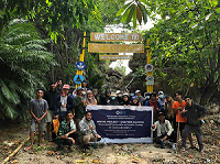
Gerbang Oluhuta Journey.
Information and communication technology has become a necessity in all aspects of life, including the tourism sector. For this reason, the team of PHP2D created an innovative application for edu-geotourism in Oluhuta Village. The method used in the community service includes the initial planning, execution stage, monitoring and evaluation stage. The results showed the application was very functional and in accordance with the edu-geotourism concept, thus made the implementation of the edugeotourism concept in Oluhuta Village more optimal, especially in helping the surrounding community to promote and market tourist attractions in Oluhuta Village. The public and visitors could use the mobile app marketing to recognize the potential exists and available local products in Oluhuta Village. On the other hand, the obstacle found that poor internet access in Oluhuta Village caused some visitors got difficult to download the application, therefore it is designed to be used offline and the download process should be done before arriving in Oluhuta Village.
Saridjan, S. A., Manyoe, I. N., Kadekoh, N. I., Khansa, D. A., Tongkodu, M. A., & Kasim, M. N. A. S. (2022). Mobile App Marketing ‘Oluhuta Journey’as A Promotion and Marketing Tool for Edu-Geotourism in Oluhuta Village. Engagement: Jurnal Pengabdian Kepada Masyarakat, 6(2), 404-420.