
Praktikum Geologi Fisik Geologi Dinamik di Leato - Oluhuta
Praktikum Geologi Fisik dan Geologi Dinamik 2017 dilaksanakan di daerah Leato dan daerah Oluhuta, Gorontalo. Praktikum Geologi Fisik dan Geologi Dinamik diikuti oleh mahasiswa Teknik Geologi Jurusan ITK Universitas Negeri Gorontalo.
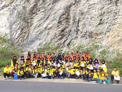
Dosen, asisten dan praktikan.
Sebelum praktikum mahasiswa wajib mengikuti coaching yang dibimbing oleh dosen dan asisten mata kuliah. Dosen Pembimbing dalam praktikum ini adalah Intan Noviantari Manyoe, S.Si., M.T dibantu oleh asisten mata kuliah yaitu Fauzul Chaidir Usman, Moh. Dio Pangulu, dan Indra Kurniawan Samir.
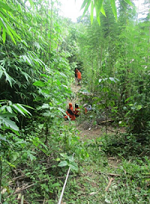
Praktikum Geomorfologi di Sungai Bone dan Botu
Praktikum Geomorfologi 2017 dilaksanakan di daerah Botu, Kota Gorontalo. Praktikum Geomorfologi diikuti oleh mahasiswa Pendidikan Geografi Jurusan ITK Universitas Negeri Gorontalo.
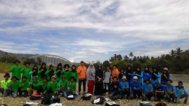
Dosen, asisten dan praktikan geomorfologi.
Sebelum praktikum mahasiswa wajib mengikuti coaching yang dibimbing oleh dosen dan asisten mata kuliah. Dosen Pembimbing dalam praktikum ini adalah Intan Noviantari Manyoe, S.Si., M.T dibantu oleh asisten mata kuliah yaitu Rezki Fauzi Duwingik, Indrawan, Moh. Dio Pangulu, dan Yemima Otoluwa.
Hydrogeology Fieldwork in Gorontalo City
Hydrogeology fieldwork 2016 was held in Gorontalo City. The fieldwork was followed by students of class '13 (Geobaper/Geoamnesia) at Geological Engineering Major, Earth Science and Technology Department, Universitas Negeri Gorontalo.
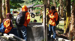
Students measure the water table.
Students observed the morphology, stratigraphy, and hydrogeology in field work location. This fieldworks are supervised by Intan Noviantari Manyoe, S.Si., MT (Lecturer), and Mohamad Mokoginta (Assistant).
15/16 Gasal was done.
Volcanology Fieldwork in Leato, Molotabu, and Nengo
Volcanology fieldwork 2016 was held at three location in Gorontalo. The fieldwork was followed by students of class '14 (Geospan) at Geological Engineering Major, Earth Science and Technology Department, Universitas Negeri Gorontalo.
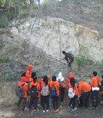
Outcrop in Leato.
Students observed the morphology, stratigraphy and geology history in fieldwork location. This fieldworks are supervised by Intan Noviantari Manyoe, S.Si., MT (Lecturer), and Febryant Masulili (Assistant).
15/16 Genap was done.
Exploration Geophysics in Lombongo
Exploration Geophysics fieldwork 2016 was held at Lombongo, Gorontalo. The fieldwork was followed by students of class '14 (Geospan) at Geological Engineering Major, Earth Science and Technology Department, Universitas Negeri Gorontalo.
Electrical array.
Fieldwork includes the identification of subsurface in the field work location using geophysical instrumentation. Students were given the ability to use Resistivity Meter. The acquisition data using Wenner Configuration. They also observed the morphology, and stratigraphy in fieldwork location.
This field works are supervised by Intan Noviantari Manyoe, S.Si., MT (Lecturer), and Andri Saputra Jusuf (Assistant).
15/16 Genap was done.