
Praktikum Vulkanologi di Leato Gorontalo
Praktikum Vulkanologi 2018 dilaksanakan di daerah Leato, Kota Gorontalo. Praktikum Vulkanologi diikuti oleh mahasiswa Teknik Geologi Jurusan ITK Universitas Negeri Gorontalo angkatan 2016.
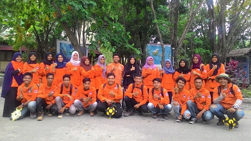
Dosen, asisten, dan praktikan vulkanologi.
Sebelum praktikum mahasiswa wajib mengikuti coaching yang dibimbing oleh dosen dan asisten mata kuliah. Dosen Pembimbing dalam praktikum ini adalah Intan Noviantari Manyoe, S.Si., M.T dibantu oleh asisten mata kuliah yaitu Reski Fauzi Duwingik dan pendamping asisten Indra Kurniawan Samir.
Praktikum Kosmografi di Pinomon Tiga
Pratikum Kosmografi 2018 dilaksanakan di Pantai Pinomon Tiga, Kabupaten Bone Bolango. Praktikum Kosmografi diikuti oleh mahasiswa Pendidikan Geografi angkatan 2015. Dosen pembimbing praktikum adalah Intan Noviantari Manyoe, S.Si., M.T. Persiapan pembuatan Planisphere dibantu oleh Siti Napu.
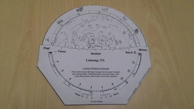
Planisphere yang digunakan dalam praktikum.
Praktikan menggunakan planisphere dan aplikasi berbasis android saat praktikum di lapangan. Pelaksanaan praktikum dimulai pada pukul 19.30 WITA. Pengamatan terhadap benda-benda langit berakhir pada pukul 22.00 WITA.
Praktikum Geomorfologi di Sungai Bone
Praktikum Geomorfologi 2018 dilaksanakan di daerah Botu, Kota Gorontalo. Praktikum Geomorfologi diikuti oleh mahasiswa prodi Teknik Geologi Jurusan ITK Universitas Negeri Gorontalo angkatan 2017.
Dosen, asisten dan praktikan geomorfologi.
Sebelum praktikum mahasiswa wajib mengikuti coaching yang dibimbing oleh dosen dan asisten mata kuliah. Dosen Pembimbing dalam praktikum ini adalah Intan Noviantari Manyoe, S.Si., M.T dan Rahmad Lahay, S.Si., M.Si, asisten mata kuliah yaitu Anggun Farwati Abdullah serta asisten pendamping kelompok Dewi Darmayanti Tolodo, Siti Fatimah, Fatma Usman, dan Widya Annisa.
Praktikum Geofisika di Pancuran dan Pentadio
Praktikum Geofisika 2017 dilaksanakan di daerah Pancuran, Kabupaten Bone Bolango dan daerah Pentadio Kabupaten Gorontalo. Praktikum Geofisika diikuti oleh mahasiswa Teknik Geologi dan Pendidikan Geografi Jurusan ITK Universitas Negeri Gorontalo.
Mahasiswa Teknik Geologi melaksanakan praktikum di Daerah Pancuran. Mahasiswa Pendidikan Geografi melaksanakan praktikum di Daerah Pentadio.
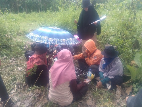
Kegiatan akuisisi data di lapangan.
Sebelum praktikum mahasiswa wajib mengikuti coaching yang dibimbing oleh dosen dan asisten mata kuliah. Dosen Pembimbing dalam praktikum ini adalah Intan Noviantari Manyoe, S.Si., M.T dibantu oleh asisten mata kuliah yaitu Faldy Koungo dan Siti S.S. Napu untuk Pendidikan Geografi Kelas A, Siti Khotijah Pomalango dan Tedy Harianto Salama untuk Pendidikan Geografi Kelas B, Dewi Darmayanti Tolodo dan Anggun Farwati Abdullah untuk Teknik Geologi.
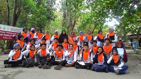
Praktikum Geologi Indonesia di Leato
Praktikum Geologi Indonesia dilaksanakan di daerah Leato, Gorontalo. Praktikum Geologi Indonesia diikuti oleh mahasiswa Pendidikan Geografi Jurusan ITK Universitas Negeri Gorontalo.
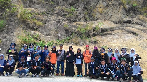
Dosen, asisten dan praktikan.
Sebelum praktikum mahasiswa wajib mengikuti coaching yang dibimbing oleh dosen dan asisten mata kuliah. Dosen Pembimbing dalam praktikum ini adalah Intan Noviantari Manyoe, S.Si., M.T dibantu oleh asisten mata kuliah yaitu Ika Ariska R Bioto dan Anggun Farwati Abdullah.