
Kajian Geologi Bawah Permukaan Daerah Geotermal Bongongoayu, Kecamatan Boliyohuto, Kabupaten Gorontalo, Provinsi Gorontalo
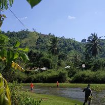
Kegiatan lapangan (sumber: Lia Elviyanti).
Daerah penelitian secara administratif berada di Kecamatan Boliyohuto, Kabupaten Gorontalo, secara fisiografi daerah penelitian berada di lembah paguyaman yang didominasi oleh batuan gunungapi dan endapan danau. Penelitian ini bertujuan untuk mengetahui geologi bawah permukaan daerah Bongonggoayu. Metode yang digunakan dalam penelitian ini menggunakan geolistrik konfigurasi Wenner-Sclumberger. Hasil penelitian geologi bawah permukaan daerah penelitian menggunakan geolistrik Wenner-Schlumberger terbagi atas 4 lintasan berdasarkan pengolahan Res2dinv dan rockword terdapat beberapa lapisan litologi berdasarkan penampang 2D bawah permukaan dimana didominasi oleh lapisan kelompok batupasir, lempung dan pasir kerikil. Kemudian terdapat anomali yang kemungkinan besar pada anomali ini terdapat pengaruh struktur dengan arah barat laut-Tenggara pada lintasan 1 dan lintasan 4.
Elviyanti, L., Maryati, S., & Manyoe, I. N. (2022). Kajian Geologi Bawah Permukaan Daerah Geotermal Bongongoayu, Kecamatan Boliyohuto, Kabupaten Gorontalo, Provinsi Gorontalo. JRST (Jurnal Riset Sains dan Teknologi), 6(2), 125-130.
Exploration Geophysics Fieldwork in Pancuran
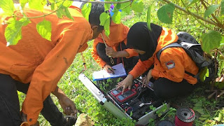
Data acquisition.
Exploration Geophysics field work 2015 was held in Pancuran, Bone Bolango Regency, Gorontalo. The field work was followed by students of class '13 (Geobaper & Geoamnesia) at Geological Engineering Major, Earth Science and Technology Department, Universitas Negeri Gorontalo.
Field work includes the identification of subsurface in the field work location using geophysical instrumentation. Students were given the ability to use Resistivity Meter. They also observed the morphology, stratigraphy, and physical-chemistry of hot springs in field work location.
This field works are supervised by Intan Noviantari Manyoe, S.Si., MT (Lecturer), and Andri Saputra Jusuf (Assistant).
Geomorphology Fieldwork in Botu
Geomorphology field work 2014 was held in Bone River and Botu Mountains, Gorontalo. The field work was followed by students of class '14 at Geography Education Major, Earth Science and Technology Department, Universitas Negeri Gorontalo. Field work includes the identification of landforms in the field work location. Students were given the ability to use compass, read a map and do the plot position on a map. This field works are supervised by Intan Noviantari Manyoe, S.Si., MT (Lecturer), Febryant Masulli (Assistant Coordinator), Nurfauziah Kadir (Vice Koas), Fidhy Kurnia Damopolii (Assistant), Novita Putri Mokodompit (Assistant), Tober Mardain (Assistant), Djamal Adi Nugroho Uno (Assistant) and Mohamad Mokoginta (Assistant).
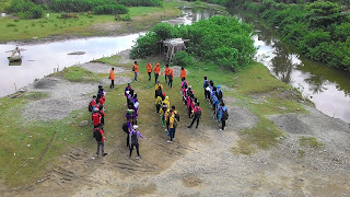
Figure 1. Start the field work from Bone River
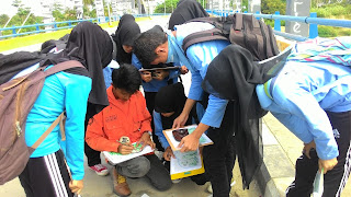
Figure 2. Blue group plot position on a map
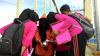
Figure 3. Pink Group plot position on a map
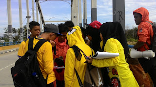
Figure 4. Yellow Group plot position on a map
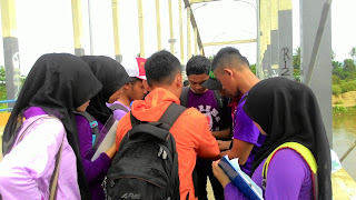
Figure 5. Purple Group plot position on a map
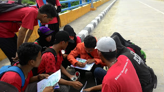
Figure 6. Red Group plot position on a map
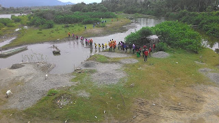
Figure 7. Move to the next station
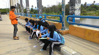
Figure 8. Blue Group field work test
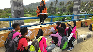
Figure 9. Pink Group field work test
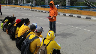
Figure 10. Yellow Group field work test
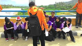
Figure 11. Purple Group field work test
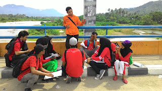
Figure 12. Red Group field work test
Figure 13. Students observed the landform at Bone River
Figure 14. Students make a sketch of landform in front of Botu Mountains
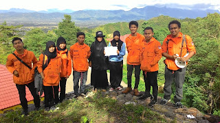
Figure 15. Fitri Sumaji got awarded as the best sketcher
Figure 16. Assistant and students
Penghargaan
Internasional
- Certificate of Commendation, Success in Research of Household Survey of Rural Livelihoods in Kecamatan Suwawa Timur in Gorontalo. Graduate School of Science and Engineering - Ehime University, Research Center for Sustainability and Environment - Shiga University, and School of Global Humanities and Social Sciences - Nagasaki University. 2017.
- The First Winner of The Best Poster. International Conference of TREPSEA. 2018.
Nasional
- BPPDN Awardee. DIKTI. 2011.
- Piagam Penghargaan, Dosen Pendamping Program Kreativitas Mahasiswa - Penelitian Eksakta (PKM-PE) Gunung Api Colo. DITJEN BELMAWA DIKTI. 2017.
- Piagam Penghargaan, Dosen Pendamping Program Kreativitas Mahasiswa - Penelitian Eksakta (PKM-PE) Geotermal Pangi. DITJEN BELMAWA DIKTI. 2017.
- Piagam Penghargaan, Dosen Pendamping Program Kreativitas Mahasiswa - Artikel Ilmiah (PKM-AI). DITJEN BELMAWA DIKTI. 2018.
- Piagam Penghargaan, Dosen Pendamping Program Kreativitas Mahasiswa - Penelitian Eksakta (PKM-PE) GORR. Rektor Universitas Negeri Yogyakarta. 2018.
- Piagam Penghargaan, Dosen Pendamping Program Kreativitas Mahasiswa (PKM) – Juara Favorit pada Pekan Ilmiah Mahasiswa Nasional (PIMNAS) 31 di Yogyakarta. Rektor Universitas Negeri Yogyakarta. 2018.
- Piagam Penghargaan, Dosen Pendamping Program Kreativitas Mahasiswa - Penelitian Eksakta (PKM-M). DITJEN BELMAWA DIKTI. 2019.
- Piagam Penghargaan, Dosen Pendamping Program Kreativitas Mahasiswa (PKM) – Pekan Ilmiah Mahasiswa Nasional (PIMNAS) 32 di Bali. DITJEN BELMAWA DIKTI. 2019.
- Tanda Kehormatan Satyalancana Karya Satya X Tahun. Presiden Republik Indonesia. 2019.
- Piagam Penghargaan, Dosen Pendamping Program Kreativitas Mahasiswa - Penelitian Eksakta (PKM-PE) Eco-Geotourism Olele. DITJEN BELMAWA DIKTI. 2020.
- Piagam Penghargaan, Dosen Pendamping Program Kreativitas Mahasiswa (PKM) – Pekan Ilmiah Mahasiswa Nasional (PIMNAS) 33 di Yogyakarta. DITJEN BELMAWA DIKTI. 2020.
- Piagam Penghargaan, Dosen Pendamping Program Holistik Pembinaan dan Pemberdayaan Desa (PHP2D), 20 Tim Terbaik Nasional. DITJEN BELMAWA DIKTI. 2020.
- Piagam Penghargaan, Dosen Pendamping Program Kreativitas Mahasiswa - Artikel Ilmiah (PKM-AI). DITJEN BELMAWA DIKTI. 2021.
- Piagam Penghargaan, Dosen Pendamping Program Holistik Pembinaan dan Pemberdayaan Desa (PHP2D). DITJEN BELMAWA DIKTI. 2021.
- Piagam Penghargaan, Dosen Pendamping Program Pengembangan Pemberdayaan Desa (P3D), Juara 1 Nasional Kategori ORMAWA - DITJEN BELMAWA DIKTI. 2021.
- Juara 3, Dosen Pendamping P3D. DITJEN BELMAWA DIKTI. 2021.
- BPI Awardee. DIKTI. 2022.
Lokal
- Piagam Penghargaan, Peserta Terbaik - Latihan Dasar Kepemimpinan: Intelektual, Dedikasi, dan Kreativitas (INDEKS) I, Himpunan Mahasiswa Fisika (HIMAFI), Universitas Hasanuddin. 2001.
- Piagam Penghargaan, Peserta Terbaik - Latihan Dasar Kepemimpinan: Intelektual, Dedikasi, dan Kreativitas (INDEKS) II, Himpunan Mahasiswa Fisika (HIMAFI), Universitas Hasanuddin. 2002.
- Juara 3, Dosen Berprestasi. Fakultas Matematika dan Ilmu Pengetahuan Alam, Universitas Negeri Gorontalo. 2018.
- Dosen Penggerak Prestasi Kemahasiswaan Terbaik 2020. Rektor Universitas Negeri Gorontalo. 2020.
- Dosen Penggerak Berprestasi 2021. Rektor Universitas Negeri Gorontalo. 2021.
- Peringkat 2, Tenaga Pendidik dengan Publikasi Terindeks Scopus Terbanyak. Rektor Universitas Negeri Gorontalo. 2024.
Pembicara/Narasumber
- Pembicara pada Seminar Batu Akik: Perspektif Sosiologi, Sejarah, Ekonomi dan Geologi. Jurusan Sosiologi Universitas Negeri Gorontalo, Indonesia. Batu Akik dalam Perspektif Geologi. 2015.
- Narasumber di TV One, Trans TV, Mimoza TV, TVRI Gorontalo dan Gorontalo Post. Mengenal Batu Akik Secara Geologi. 2015.
- Narasumber di TVRI Gorontalo. Peran Laboratorium Teknik Geologi di Tengah Maraknya Batu Akik. 2015.
- Pembicara pada Festival Batu Akik Nusantara. Penjelasan Ilmiah Batu Akik dalam Tinjauan Geologi. 2015.
- Narasumber di Liputan6.com dan Gorontalo Post. Penjelasan Ilmiah terkait Penemuan Batu Mirip Giok di Desa Huwali, Kota Gorontalo. 2015.
- Pembicara pada Kegiatan Geowisata, Himpunan Mahasiswa Teknik Geologi John Ario Katili, Universitas Negeri Gorontalo. Kepemimpinan. 2015.
- Narasumber di Kompas.com. Adakah Danau Kembar di Gorontalo? 2015.
- Pembicara pada Latihan Dasar Kepemimpinan, Himpunan Mahasiswa Teknik Geologi John Ario Katili, Universitas Negeri Gorontalo. Dinamika Kelompok. 2016.
- Pembicara pada Latihan Dasar Kepemimpinan, Himpunan Mahasiswa Teknik Geologi John Ario Katili, Universitas Negeri Gorontalo. Bina Karakter. 2017.
- Pembicara pada Masa Orientasi Mahasiswa Baru (MOMB) Tahap II, Teknik Geologi Universitas Negeri Gorontalo. Tips Lolos Program Kreativitas Mahasiswa (PKM). 2018.
- Pembicara pada Komunikasi Ilmiah Lintas Fakultas, Fakultas Ekonomi dan Bisnis, Universitas Negeri Gorontalo. Rahasia dibalik Pendanaan PKM Teknik Geologi. 2019.
- Pembicara pada Penalaran dan Keilmuan, Himpunan Mahasiswa Teknik Geologi John Ario Katili, Fakultas MIPA, Universitas Negeri Gorontalo. Teknik Geologi go to PIMNAS Again. 2019.
- Pembicara pada Pelatihan Kepemimpinan dan Kreativitas, Lembaga Dakwah Fakultas MIPA Al Faraby. Creative or ‘Died’. 2019.
- Pembicara pada Seminar Nasional Ekskursi Geologi Regional Sulawesi-Kalimantan, Persatuan Himpunan Mahasiswa Geologi Indonesia. Geotermal Daerah Gorontalo dan Implikasinya bagi Pembangunan Berkelanjutan di Provinsi Gorontalo. 2020.
- Narasumber di RRI Gorontalo. Pengembangan Wisata Hiu Paus dan Batu Berani di Desa Botubarani. 2020.
- Pembicara pada Workshop Program Kreativitas Mahasiswa, Fakultas Ilmu Pendidikan UNG. Tips Lolos PKM dan PHP2D. 2021.
- Narasumber di RRI Gorontalo. Prestasi Mahasiswa Program PHP2D Pengembangan Wisata Hiu Paus dan Batu Berani di Desa Botubarani. 2021.
- Pembicara pada Sayembara Geowisata Indonesia. Masyarakat Geowisata Indonesia berkolaborasi dengan Kementerian PUPR. Geowisata Lombongo. 4 Agustus 2021.
- Pembicara pada Geotourism Festival & International Conference 2021, Rinjani-Lombok UNESCO Global Geopark berkolaborasi dengan Asia Pacific Geoparks Network. Virtual Geotour Aspiring Geopark Gorontalo. 7 Agustus, 2021.
- Narasumber di RRI Gorontalo. Pengembangan Edu-Geotourism di Desa Oluhuta. 2021.
- Panelis pada Semiloka Abdidaya 2021: Kolaborasi dan Inovasi Pemberdayaan dan Pengembangan Ekosistem Bisnis Desa. Institut Pertanian Bogor. 2021.
- Pembicara pada Pelatihan Penulisan PKM “Informatika menuju PIMNAS 2022”. Proses Pembimbingan PKM. Teknik Informatika Fakultas Teknik Universitas Negeri Gorontalo. 2022.