
Landslide Analysis based on Rock Mass Classification and Kinematic Analysis in Daenaa Area, Gorontalo
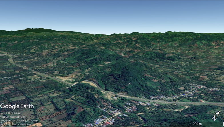
Research location.
Gorontalo province crossed by a Gorontalo fault with a movement of around 11 mm/year. The existence of this fault zone affects the distribution and configuration of geological structures and increases the potential for landslide in the Gorontalo area, especially areas that crossed by Gorontalo fault such as Daenaa. This study aims to identify rock mass classification and using kinematics analysis to landslideprone sites in the Daenaa and surrounding areas. The method used consists of geological observations, Scanline Mapping, rock mass classification using Rock Mass Rating (RMR), Slope Mass Rating (SMR), and kinematics analysis on slopes. The results showed the slope mostly composed of partially weathered andesite rocks. The slope discontinuities dominated by fractures either affected by tectonic or weathering. Scanline mapping and rock mass classification are focused at 4 stations namely SC 1, SC 2, SC 3, and SC 4. The RMR classification results indicate the rock class consists of 2 classes, namely Good Rock and Fair Rock. SMR classification shows the slopes consist of stable and partially stable. Kinematics analysis shows the failure type is toppling failure. The results of observations indicate the role of the geological structure in the Daenaa area is influential in controlling landslide in the study area. Fracture is the main factor causing landslide. The occurrence of minor faults in the study area also decreases the stability of the rock slope. This condition makes it necessary to take action in the surrounding community of Daenaa area related to mitigation of mass movement disasters.
Usman, F.C.A., Manyoe, I.N., & Kasim, M. 2020. Landslide Analysis based on Rock Mass Classification and Kinematic Analysis in Daenaa Area, Gorontalo. The 49th IAGI Annual Convention & Exhibition. IAGI, Lombok.
3D Modeling of Olele Eco-Geotourism Area Based on Satellite Imaging, Geology, and Marine Analysis
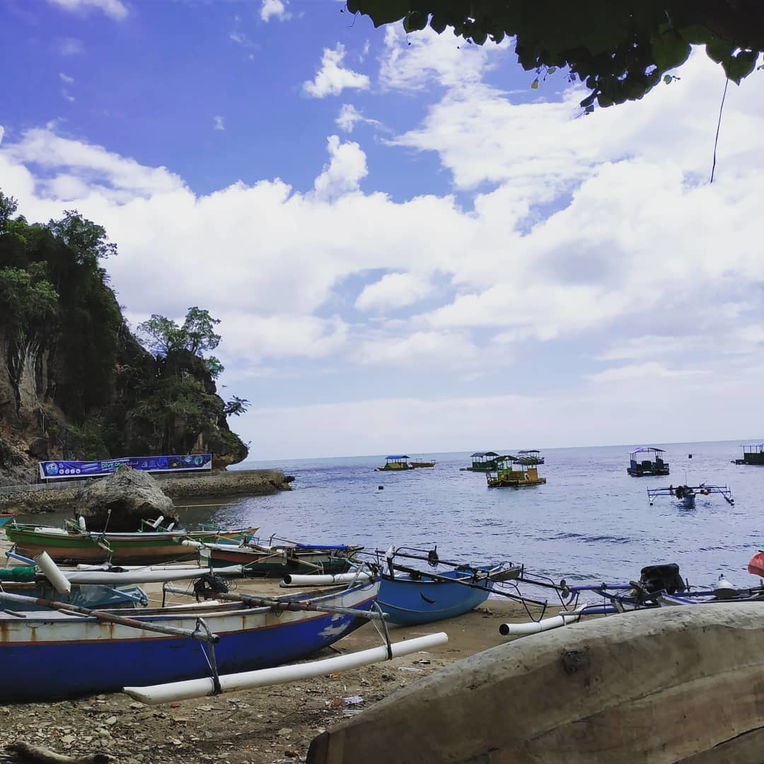
Olele Beach.
The identification of the potential for eco-geotourism is not sufficient to reveal the potential of the Olele area so that technological innovation is needed to model the design of the eco-geotourism area. The purpose of this research is to make a 3D modeling of Olele eco-geotourism area design based on satellite, geological, and marine data analysis. This research method uses satellite image data technology combined with a literature review. Satellite imagery uses the National Digital Elevation Model (DEMNAS) and National Bathymetry (BATNAS) which are processed and analyzed using the GIS application. Literature review refers to books, journals, and maps related to research topics. The results showed that the Olele region has two potential geosites and four potential ecosites. Satellite image data technology not only produces terrestrial topographical models, bathymetry models, and slope class map but also can show the relationship between openings in Jin Cave controlled by geological structures on land, and the unique relationship between Petrosia lignosa and the Olele underwater carbonate shelf model of Olele. Based on the identification and comparison of geosite and ecosite, the Olele area is unique on a local, national, and international scale.
Keywords: 3D Model, Geosite, Ecosite, Ancient Volcano, Coral Reef.
Abduh, A. G., Usman, F. C. A., Tampoy, W. M., & Manyoe, I. N. (2020). 3D Modeling of Olele Eco-Geotourism Area Based on Satellite Imaging, Geology, and Marine Analysis. Journal of Earth Sciences and Technology, 1(2), 90-101.
Geology of Lahilote Folklore as a Site to Develop Geotourism in Gorontalo
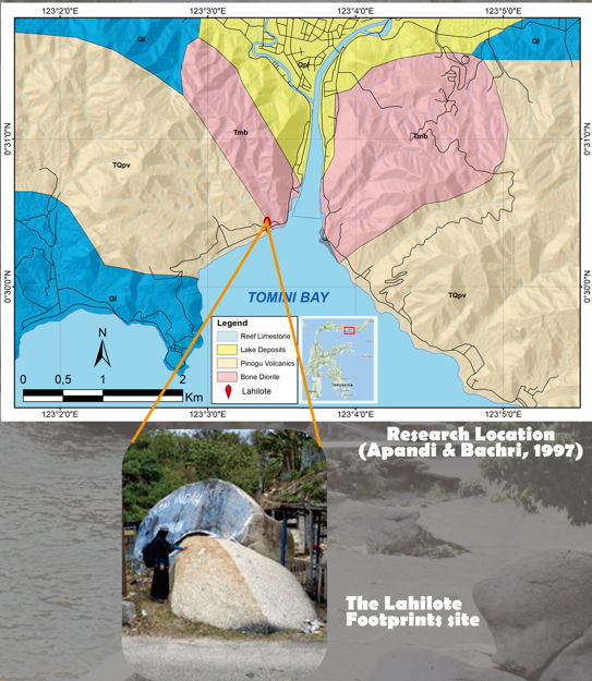
Lahilote footprints in granodiorite rock.
Lahilote folklore is Gorontalo folklore about the footprints of a man named Lahilote. Lahilote footprints are sculpted on rocks located on the southern coast of Gorontalo. Lahilote folklore has been studied by Gorontalo cultural experts, but there is no paper in the field of geology. This study aims to assess the Lahilote footprint site based on its geological characteristics. This research is expected to contribute to the development of geotourism in Gorontalo. The method used is field observation and laboratory analysis. Geosite analysis using the classification of geosite and geomorphosite according to Kubalikova quantification parameters. Field observations include geomorphological and field geological surveys. Rock samples taken from the Lahilote footprint site. Laboratory analysis includes a petrographic analysis and Scanning Electron Microscopy (SEM). The results showed that the Lahilote footprint site was in the intrusion hilly unit. Lahilote footprint sites are formed due to the presence of veins in rocks. The destruction of the side of the rock at the vein boundary leaves the other side of the rock which resembles a footprint. The general description of cite is medium to coarse grained, phaneritic, holocrystalline, hypidiomorphic granular, consists of quartz, alkaline feldspar, plagioclase and mafic minerals. The Lahilote footprint site is granodiorite rock. Based on petrographic analysis, rock-forming minerals are Bt (biotite), Hbl (hornblende), Opq (opaq), Pl (plagioclase), and Qz (quartz). The results of interpretation using SEM show element prediction data contained in rock samples. Lahilote footprint rock sites contain elements of Silicon, Titanium, Allumunium, Ferrum, Manganese, Magnesium, Calcium, Sodium, Potassium, and Cromium. The feasibility values in the geosite and geomorphosite assessments consisting of scientific and intrinsic values (3.5), education values (3), economics values (1), conservation values (2.5, and additional values (2.5) indicate that the geosite Lahilote footprint is feasible to be developed to support geotourism in Gorontalo.
Manyoe, I.N., Masulili, F., & Hutagalung, R. 2020. Geology of Lahilote Folklore as a Site to Develop Geotourism in Gorontalo. The 49th IAGI Annual Convention & Exhibition. IAGI, Lombok.
Sociodemographic attributes and dependency on artisanal and small-scale gold mining: The case of rural Gorontalo, Indonesia
Field location.
The objective of this research is to investigate the livelihoods of villagers of rural Gorontalo, where limited job opportunities and poor infrastructure impede improvements in rural settlements. The research focused on rural regions where small-scale gold mining (ASGM) activities are prevalent in the economy. Given the associated complexities of the livelihoods of the villagers, the paper pays particular attention to household income and its sources and then examines associations with key socioeconomic variables, focusing especially on the contribution of educational development. The questionnaire survey was conducted among households in five villages of rural Gorontalo in August 2017, and 310 effective samples were collected. The results indicate that more affluent households receive a higher proportion of income from formal public sectors, such as government institutions. The source of income from mining accounts for approximately 20%, which is almost constant across the income quartiles. Fractional logit models were employed to examine the dependency of household income on mining. The estimation results indicate that educated households depend less on mining income than do uneducated households. Households with young household heads receive less income from mining than do those with old household heads. The paper implies that low educational attainments are related to a higher dependency on mining, probably due to limited job opportunities in the formal sector. Therefore, improvements in educational attainment are associated with a reduced dependency on the mining sector. The results yield key information for formulating policies for remote villages where a substantial improvement in rural livelihoods is pivotal to reduce dependency in the context of poor ASGM regions.
Komatsu, S., Tanaka, K., Sakakibara, M., Arifin, Y. I., Pateda, S. M., & Manyoe, I. N. (2020, November). Sociodemographic attributes and dependency on artisanal and small-scale gold mining: The case of rural Gorontalo, Indonesia. In IOP Conference Series: Earth and Environmental Science (Vol. 589, No. 1, p. 012020). IOP Publishing.
Sediment material potential of Bone River as a prevention of silting and flood of Bone River estuary, Gorontalo
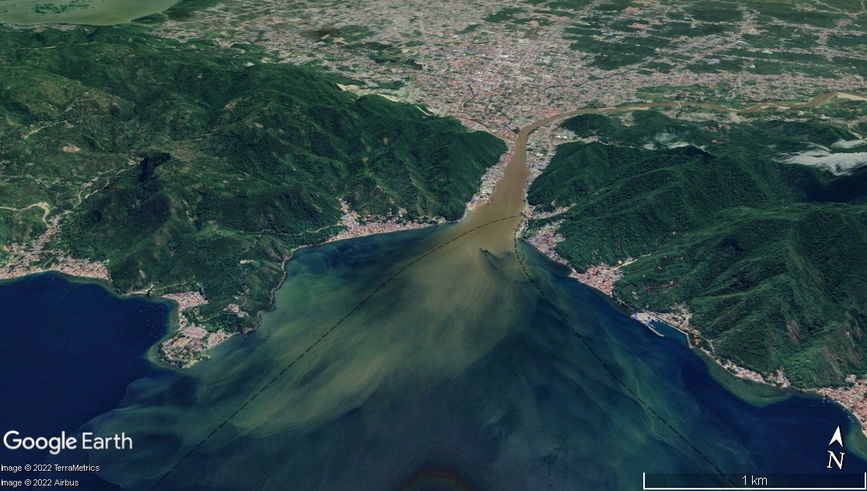
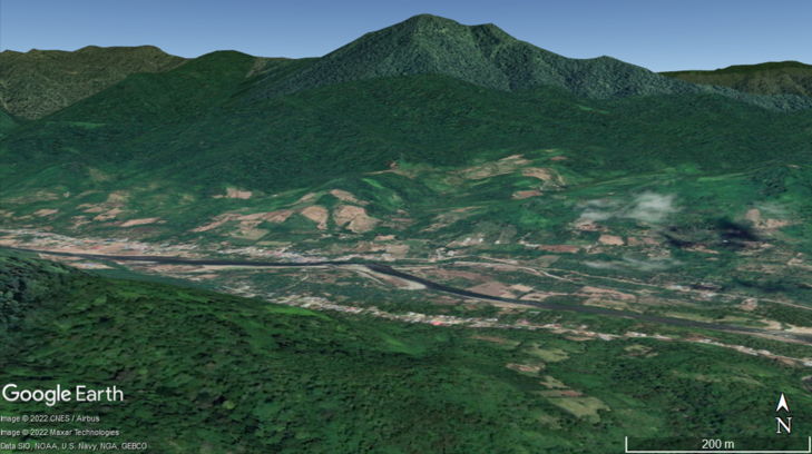
Bone River estuary. Sediments are transported by river currents towards the estuary and Gorontalo Bay.
Bone River Estuary acts as a connecting lane between the three rivers (Bolango River, Bone River, and Tamalate River) with Tomini Bay. There is a port activity of goods located right on the river estuary, which is potentially disrupted due to the silting and can cause flood. This situation will undoubtedly disrupt port transportation routes and affect the economic condition of Gorontalo. The aim of this research is to identify the potential of sediment utilization at the downstream of the Bone River as an effort to prevent siltation at the estuary of river Bone, Gorontalo and to prevent flood. The method used in this research is field observation which includes observation of the morphological condition of research location and sampling. Samples will then be processed by means of sieving, separation, and classification of Sphericity sediment material by referring to zoning classification and Sneed and Folk classification. The result of histogram data showed that the sediment material was dominated by coarse sand size and grain size distribution dominated by coarse sand with size of phi is 0, on sediment data showed generally very leptokurtic with skewed skill or highly skewed.
Napu, S. S. S., Salama, T. H., Manyoe, I. N., Usman, F. C. A., Samir, I., Badaru, A. W. W., & Sugianti, K. (2020, November). Sediment material potential of Bone River as a prevention of silting and flood of Bone River estuary, Gorontalo. In IOP Conference Series: Earth and Environmental Science (Vol. 589, No. 1, p. 012003). IOP Publishing.