
Produk Samudera dan Pendatang Gelap di Ponelo Kepulauan
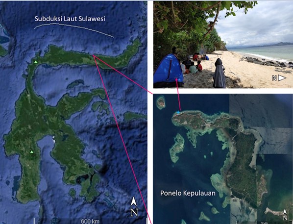
Lokasi Ponelo Kepulauan (Google Earth, 2018).
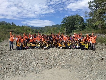
Ponelo Kepulauan bukanlah pulau destinasi wisata. Berbeda dengan Pulau Saronde dan jajaran pulau pasir putih di Utara Gorontalo. Saya telah dua kali ke Pulau Saronde, sekali ke Pulau Bogisa dan Pulau Lampu. Alih-alih mengunjungi kembali tiga pulau itu atau pulau wisata lainnya di perairan Kwandang, menemukan destinasi baru tampaknya cukup menyenangkan. Dua hari kami di sana, inilah yang kami temukan di Ponelo Kepulauan: produk samudera/lautan dan ‘pendatang gelap’ dari luar negeri.
Basal
Ponelo Kepulauan dalam Peta Geologi Regional Lembar Tilamuta oleh Bachri, Sukido dan Ratman (1993) Skala 1:250.000 tersusun atas Formasi Lokodidi (TQls). Satuan-satuan dalam Formasi Lokodidi adalah konglomerat, batupasir, batupasir konglomeratan, batupasir tufan, tuf, batulempung dan serpih hitam. Semua batuan penyusun Ponelo Kepulauan dalam peta geologi regional adalah batuan sedimen. Hari kedua kami di sana, kami menemukan batuan beku.
Jenis batuan beku di Ponelo Kepulauan adalah basal. Basal berwarna gelap dan umumnya merupakan batuan ekstrusif (aliran lava). Selain di Bumi, basal juga ditemukan di Bulan dan di Planet Mars pada Olympus Mons (gunungapi terbesar di tata surya). Ada tiga lingkungan pembentukan basal yaitu: 1) batas divergen di kerak samudera, 2) hotspot di kerak samudera, dan 3) hotspot di kerak benua. Berdasarkan penelitian terdahulu, lingkungan pembentukan basal Ponelo Kepulauan yang paling mungkin adalah pada batas divergen di kerak samudera atau pemekaran di Laut Sulawesi.
‘Terapung-apung’ di tengah atlantik sana, terdapat Islandia (Iceland) yang juga terbentuk pada batas divergen di kerak samudera. Di Black Sands Beach, Islandia terdapat pillow basalt dan big boulder. Big boulder basalt ini memperlihatkan vertical stripes seperti pada basal di Ponelo Kepulauan.
Tombolo
Ponelo Kepulauan terdiri atas dua pulau yaitu Pulau Otilode dan Pulau Panyunga. Dulu kedua pulau ini terpisah tapi sekarang oleh proses geomorfologi terbentuk daratan yang menghubungkan kedua pulau. Dalam ilmu geomorfologi, satuan yang menghubungkan satu pulau dengan pulau lainnya disebut tombolo. Tombolo terbentuk karena proses marine dengan bantuan gelombang/arus laut.
Nelayan yang kami tumpangi perahunya menceritakan semasa beliau SD dulu, kedua pulau ini masih terpisah. Saat ini pak nelayan berumur sekitar 60-an. Jadi butuh puluhan tahun bagi arus dan gelombang laut untuk membawa pasir kasar dan halus, membentuk tombolo di Ponelo Kepulauan. Saat ini di atas tombolo telah berdiri bangunan sekolah dan rumah-rumah penduduk.
Tombolo terbentuk karena proses marin. Saat ombak mendekat ke daratan atau pulau utama, ombak melambat dan menyapu sedimen dari kedua sisi. Endapan mulai terbentuk. Awalnya berbentuk seperti lidah (dikenal dengan spit) yang lama kelamaan akan terhubung dengan pulau dan membentuk tombolo.
‘Pendatang Gelap’
Basal dan tombolo adalah produk samudera/lautan. Basal berasal dari pemekaran lantai samudera dan tombolo terbentuk karena gelombang dan arus laut. Lalu siapa ‘pendatang gelap’ dari luar negeri di Ponelo Kepulauan? Check it out.
- From Philiphine
Pendatang pertama dari Filipina yaitu Nature’s Spring dari Philippine Spring Water Resources, Alco Plus dari Bulacan, Manila, Philippine, dan Studio yang merupakan produk Coca Cola Philippines Facebook Messenger. Inilah ‘pendatang gelap’ yang saya maksud: produk botol plastik luar negeri yang terombang-ambing di lautan dan terdampar di Ponelo Kepulauan.
- From Malaysia
Pendatang dari Malaysia adalah botol plastik air mineral dengan merek OK, Eagle, Q1, dan K2. Produk air mineral ini berasal dari Kota Sabah, Malaysia.
From Japan
Selain produk Filipina dan Malaysia, sampah botol plastik dari jepang juga ditemukan di pesisir Ponelo. Tahun 2011, Jepang pernah dilanda tsunami dan banyak sampah yang terbawa oleh gelombang dan arus laut.
Plastik dan Potensi Geowisata
Sampah plastik yang datang setiap hari di Ponelo Kepulauan belum dapat ditangani hingga saat ini. Desa-desa di Ponelo Kepulauan satupun tidak memiliki bank sampah. Tindakan satu-satunya dari masyarakat hanyalah membakar sampah-sampah plastik padahal ada efek negatif dari pembakaran sampah plastik.
Di antara sampah plastik yang datang setiap hari, Ponelo Kepulauan masih menyimpan potensi geowisata yang jika dikembangkan dengan baik akan menambah daftar destinasi wisata Gorontalo Utara.
We hope that…
Desa Malambe, Ponelo Kepulauan, Gorontalo Utara, 13 – 14 April 2019.
Tulisan yang sama dapat dibaca di link eksternal.
Praktikum Geomorfologi 2022: Geomorfologi Daerah Bolihutuo
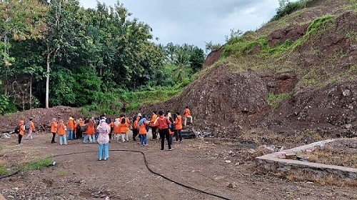
Praktikum Geomorfologi dilaksanakan di daerah Botutonuo, Kabupaten Boalemo, Provinsi Gorontalo. Praktikum Geomorfologi diikuti oleh mahasiswa prodi Teknik Geologi, Jurusan ITK, Universitas Negeri Gorontalo, angkatan 2020.
Sebelum praktikum mahasiswa wajib mengikuti coaching yang dibimbing oleh dosen dan asisten mata kuliah. Dosen Pembimbing dalam praktikum ini adalah Intan Noviantari Manyoe, S.Si., M.T dan Ronal Hutagalung, S.T., M.T. Asisten senior praktikum geomorfologi yaitu Siti Suhartini S. Napu, S.T., dan Indra Samir, S.T. Asisten junior adalah Adrianto, Della Nawarita Putri Kasim, Waode Emiria Srikandi Ndangi, Ratnasari L Madusila, Muhamad Danial Suma, Naafi Syahna Firdhaus Biya, dan Yustina Damogalad.
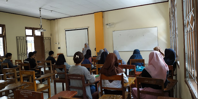
Coaching
Sebelum praktikum mahasiswa wajib mengikuti coaching yang dibimbing oleh dosen dan asisten mata kuliah.
Persiapan Keberangkatan menuju Lokasi Praktikum
Peserta berkumpul di lapangan Gedung Budaya UNG. Sebelum keberangkatan, dilakukan pemeriksaan kelengkapan praktikum oleh asisten. Peserta berangkat ke lokasi praktikum menggunakan 2 bus DAMRI.
Suplemen (Pengenalan Batugamping Merah)
Singkapan Batugamping Merah.
Dalam perjalanan menuju lokasi praktikum, rombongan singgah di singkapan Batugamping Merah. Batugamping Merah merupakan salah satu batuan tertua di Gorontalo.
Kuliah Malam
Dosen pembimbing memberikan materi geomorfologi bagi peserta praktikum. Kuliah malam dilaksanakan setelah peserta makan malam bersama dosen dan asisten. Beberapa peserta menyanyikan lagu geologi saat istirahat snack malam.
Tulisan yang sama dapat dibaca pada link eksternal.
Praktikum Geologi Fisik dan Geologi Dinamik di Pohe dan Bongo
Praktikum Geologi Fisik dan Geologi Dinamik 2019 dilaksanakan di daerah Pohe dan Bongo, Gorontalo. Praktikum Geologi Fisik dan Geologi Dinamik diikuti oleh mahasiswa Teknik Geologi, Universitas Negeri Gorontalo, angkatan 2019.
Coaching.
Sebelum praktikum mahasiswa wajib mengikuti coaching yang dibimbing oleh dosen dan asisten mata kuliah. Dosen Pembimbing dalam praktikum ini adalah Intan Noviantari Manyoe, S.Si., M.T dibantu oleh asisten Fauzul Chaidir Usman, Siti Suhartini S. Napu, Tedy Harianto Salama, Reski Fauzi Duwingik, Indra Kurniawan Samir, Moh. Dio Pangulu, Supriadi, Dewi Darmayanti Tolodo, dan Anggun Farwati Abdullah.
Praktikum Vulkanologi: Breksi Diatrem
Observasi Geologi
Praktikum volkanologi dilaksanakan di daerah Bulontala. Praktikum volkanologi difokuskan pada breksi diatrem yang ada di daerah Bulontala. Praktikum dilaksanakan pada hari Sabtu - Minggu/ 16 - 17 Maret 2019. Observasi geologi dilaksanakan pada hari Sabtu/ 16 Maret 2019. Pengamatan breksi diatrem dilaksanakan pada hari Minggu/ 17 Maret 2019. Peserta praktikum volkanologi adalah mahasiswa angkatan 2017, Prodi Teknik Geologi, Universitas Negeri Gorontalo. Dosen dan asisten pembimbing lapangan adalah Intan Noviantari Manyoe, S.Si., M.T, Fauzul Chaidir A. Usman, dan Moh. Dio Pangulu.
Kegiatan lapangan.
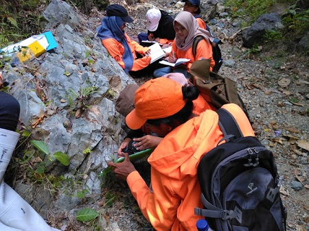
Mahasiswa melakukan pengamatan singkapan, deskripsi litologi, pengukuran struktur geologi, dan pengamatan geomorfologi di lapangan. Data pengamatan ditulis pada buku catatan lapangan. Lokasi singkapan dan pengukuran struktur geologi diplot di peta. Peta yang dibawa mahasiswa ke lapangan adalah peta topografi dan peta geologi skala 1:25.000.
Praktikum Geofisika: Akuisisi Data Geomagnet dan Geolistrik
Praktikum Geofisika 2019 difokuskan pada metode geomagnet dan metode geolistrik. Akuisisi data magnetik dilaksanakan di lapangan Catur Universitas Negeri Gorontalo. Akuisisi data geolistrik dilaksanakan di Desa Pancuran, Kabupaten Bone Bolango.
Dosen, asisten dan praktikan.
Akuisisi Data Magnetik
Praktikum Geofisika diikuti oleh mahasiswa Teknik Geologi Jurusan ITK Universitas Negeri Gorontalo angkatan 2017 dan angkatan 2018. Akuisisi data magnetik dibimbing oleh dosen Intan Noviantari Manyoe, S.Si., M.T, Asisten I Tedy Harianto Salama, dan Asisten II Indra Kurniawan Samir.
Setelah akuisisi data magnetik selanjutnya dilakukan prosesing data di Laboratorium John Ario Katili. Data magnetik dapat didownload di link ini.
Observasi Geologi
Observasi geologi dilakukan sebelum pengambilan data geolistrik. Praktikan dibagi ke dalam kelompok-kelompok yang akan dibimbing oleh dosen dan asisten. Dosen dan asisten yang akan membimbing pada observasi geologi adalah Intan Noviantari Manyoe, Fauzul Chaidir Usman, Siti Suhartini S. Napu, Tedy Harianto Salama, Indra Kurniawan Samir, Widya Annisa, Moh. Dio Pangulu, Dewi Darmayanti Tolodo, Anggun Farwati Abdullah, dan Supriadi.
- Daftar Nama Kelompok Observasi Geologi.
- Peta Topografi Daerah Pancuran.
- Peta Geologi Daerah Pancuran.
Akuisisi Data Geolistrik
Praktikum geolistrik dilaksanakan di Desa Pancuran. Instrumen yang akan digunakan adalah 1 set Resistivity meter. Dosen dan asisten lapangan adalah Intan Noviantari Manyoe, Tedy Harianto Salama, Indra Kurniawan Samir, Widya Annisa, dan Anggun Farwati Abdullah,
- Daftar Nama Kelompok Geofisika
- Modul Geofisika
Tulisan yang sama dapat dibaca pada link eksternal.