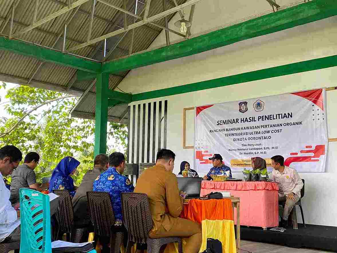
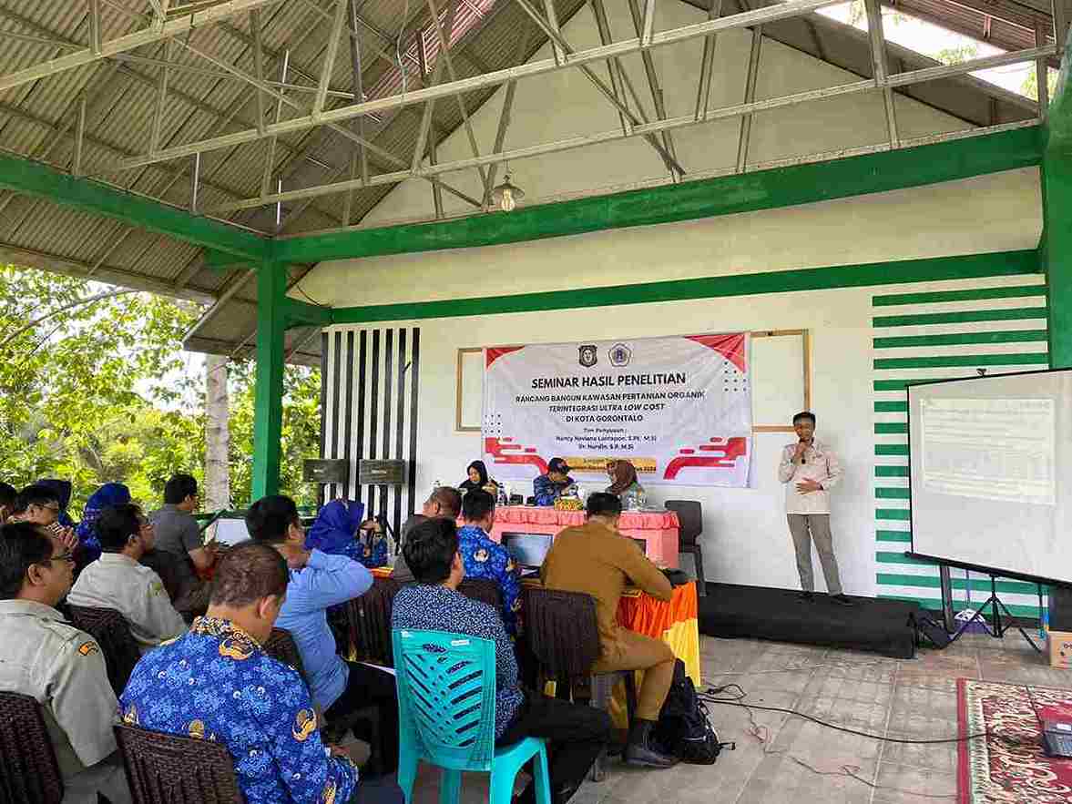
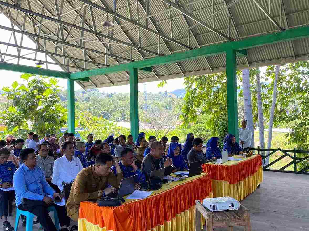
Rancang Bangun Kawasan Pertanian Organik Terintegrasi Ultra Low Cost di Kota Gorontalo
RINGKASAN EKSEKUTIF
Nurdin, Echan Adam, Rival Rahman, Silviana Arsyad
Fakultas Pertanian Universitas Negeri Gorontalo
Pekerjaan Swakelola Kerjasama Bapppeda Provinsi Gorontalo dengan Universitas Negeri Gorontalo, Tahun 2024
Provinsi Gorontalo merupakan salah satu sentra produksi pertanian yang secara konsisten membangun sektor pertanian, sehingga tampak nyata pada kontribusi sektor ini dalam pembentukan ekonomi wilayah (PDRB). meskipun tren peningkatan produksi dan produktivitas pertanian yang cenderung naik, tetapi seiring dengan pencapaian tersebut muncul permasalahan lain terutama karena banyaknya limbah pertanian yang dihasilkan dan belum tertangani secara optimal, terutama limbah pertanian di Kota Gorontalo. Penelitian ini bertujuan untuk mengelola limbah pertanian dan limbah rumah tangga menjadi pupuk organik padat dan cair yang bernilai ekonomi dan agronomis berbasis kawasan., memitigasi potensi pencemaran lingkungan akibat residu limbah pertanian dan limbah rumah tangga berbasis kawasan., dan merancang Kawasan Pertanian Organik Terintegrasi Ultra Low Cost. Penelitian ini menggunakan metode deskripsi untuk kondisi pertanian dan potensi limbah pertanian di Kota Gorontalo. Selanjutnya untuk analisis keragaan pertumbuhan dan hasil tanaman caisin dan bayam menggunakan metode eksperintal desain mengikuti pola rancangan acak lengkap (RAL). Apabila F hitung > F tabel maka dilanjutkan dengan uji DMRT pada taraf uji 5%. Analisis selanjutnya menggunakan efektivitas agronomis relatif (RAE) dan efektivitas ekonomi pupuk (EFE).
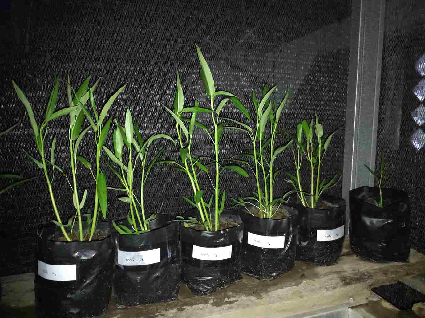
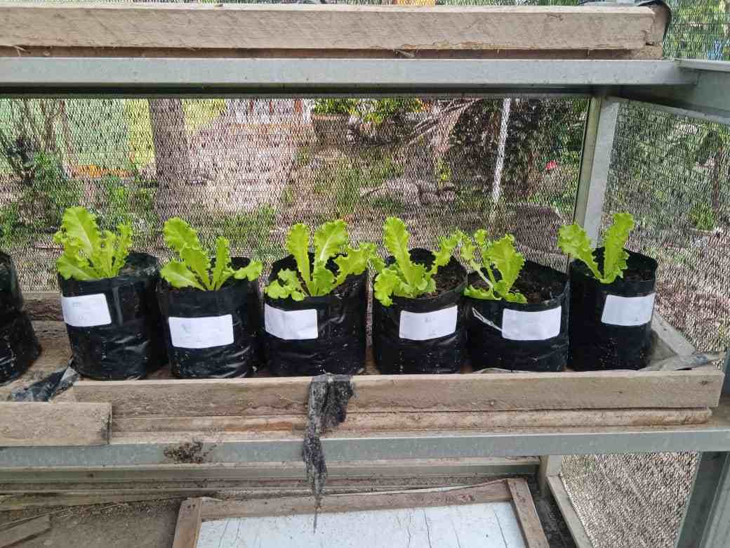
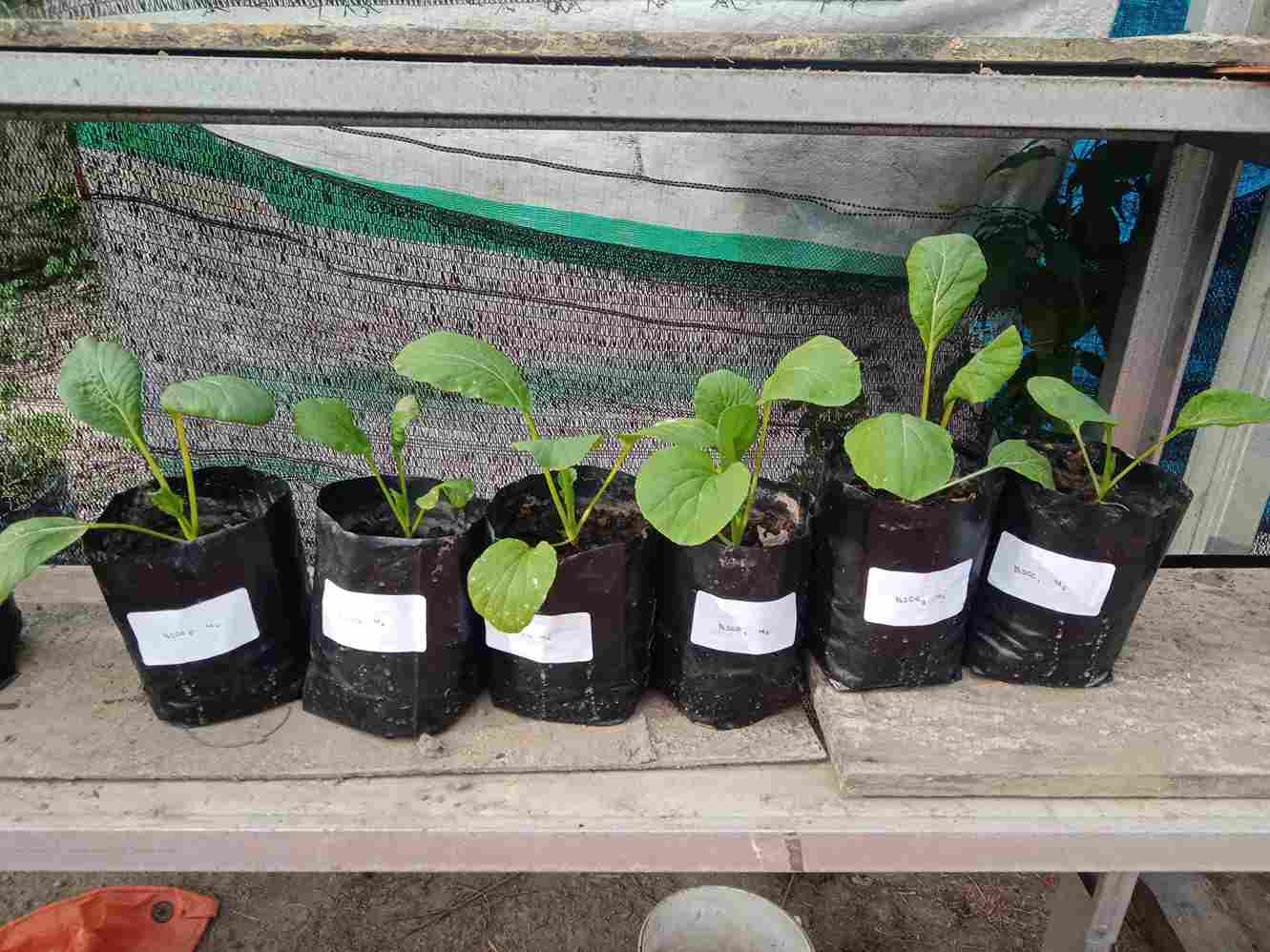
Penentuan kawasan dan klaster pengembangan pertanian organik berdasarkan kriteria yang dianalisis secara komposit. Hasil penelitian yang diperoleh menunjukkan bahwa potensi limbah pertanian sebagai bahan baku pupuk organik cukup banyak yang ditunjang oleh luas lahan pertanian, populasi ternak dan usaha pertanian baik skala perorangan maupun rumah tangga di Kota Gorontalo. Selanjutnya, pemberian pupuk organik secara nyata meningkatkan pertumbuhan dan hasil baik pada tanaman caisin maupun tanaman bayam. Pada tanaman caisin, taraf pemupukan terbaik sebanyak 5 ton/ha, sementara pada tanaman bayam taraf pemupukan terbaik sebanyak 10 ton/ha.
Efektivitas agronomis relatif (RAE) terbaik untuk tanaman caisin terdapat pada taraf pupuk organik sebanyak 5 ton/ha, demikian halnya dengan efektivitas ekonomi pupuk (EFE). Sementara efektivitas agronomis relatif (RAE) terbaik untuk tanaman bayam terdapat pada taraf pupuk organik sebanyak 10 ton/ha, demikian halnya dengan efektivitas ekonomi pupuk (EFE). Sedangkan klaster I pengembangan pertanian organik di Kota Gorontalo melingkupi Kecamatan Kota Utara, Kota Tengah dan Kecamatan Sipatana. Sementara Klaster II mencakup Kecamatan Kota Timur, Hulonthalangi dan Kecamatan Dumbo Raya. Sedangkan Klaster III mencakup Kecamatan Kota Barat, Dungingi dan Kecamatan Kota Selatan.
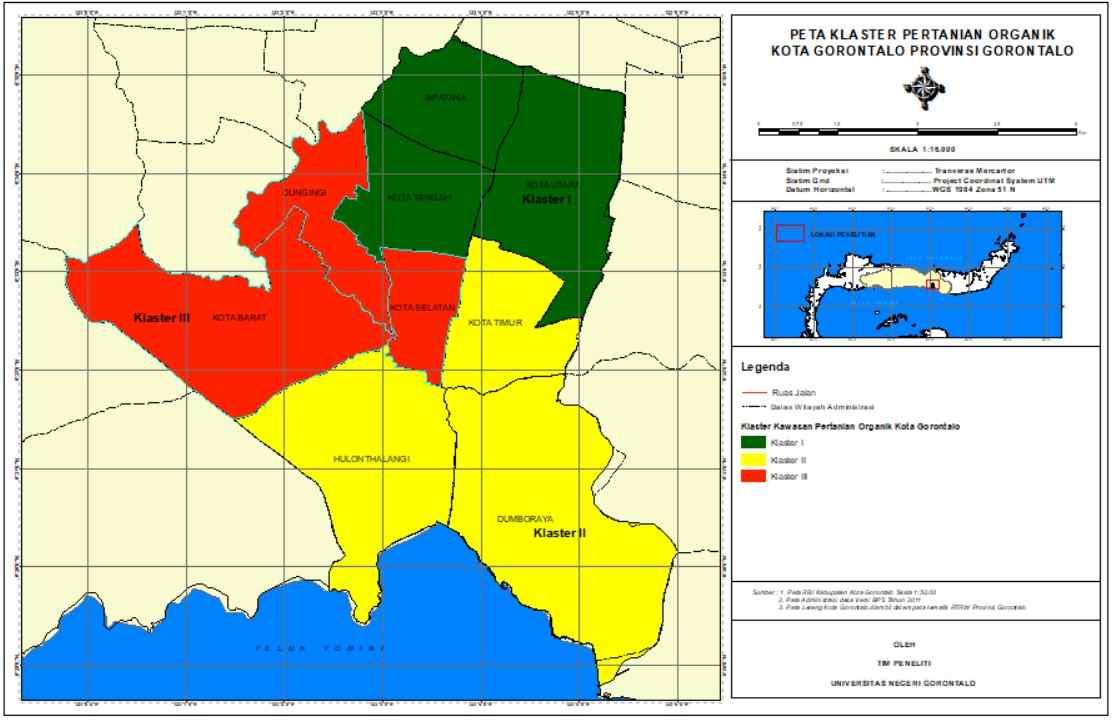
Peta klaster Pengembangan Pertanian Organik di Kota
Saran: (a) sebagai masukan bagi pemerintah daerah terutama Bapppeda Provinsi Gorontalo agar kiranya limbah pertanian yang begitu melimpah dapat dikelola dan dimanfaat sesegera mungkin., (b) pupuk organik yang telah dibuat dan diaplikasikan ke tanaman caisin dan bayam pada skala rumah kaca selanjutnya harus diuji cobakan pada lahan pertanian di lapangan, (c) nilai RAE untuk tanaman caisin dan bayam dapat ditingkatkan lagi dengan meningkatkan produksi melalui pengkayaan hara pupuk organik, sementara nilai EFE dapat ditingkatkan lagi melalui peningkatan harga komoditas caisin dan penurunan biaya produksi pupuk organik, (d) klaster pengembangan pertanian organik terintegrasi di Kota Gorontalo ini perlu dituangkan dalam roadmap dan action plan, sehingga program dan kegiatan di dalamnya dapat segera dilaksanakan secara optimal
SELAMAT HARI RAYA IDUL FITRI, 1 SYAWAL 1447 H, TAHUN 2026 M

Assalamualaikum Wr. Wb.
Perkenankan kami sekeluarga mengucapkan:
Selamat Hari Raya Indul Fitri, 1 Syawal 1447 H, Tahun 2026
Mohon maaf lahir n batin
Taqobbalallahu minna wa minkum, siyamana wa siyamakum
Wassalamu'alaikum Wr. Wb.
Prof. Dr. Ir. Nurdin, SP, MSi & Keluarga
Sebaran Spasial Tingkat Kesesuaian Lahan Tanaman Pangan pada Beberapa Sub Daerah Aliran Sungai (DAS) di Kawasan Teluk Tomini Kabupaten Boalemo

Nurdin1, Rival Rahman2*, Silvana Apriliani2
1Program Studi Magister S2 Agroteknologi, Program Pascasarjana Universitas Negeri Gorontao. nurdin@ung.ac.id
2Jurusan Agroteknologi, Fakultas Pertanian, Universitas Negeri Gorontalo. Jl. Prof. Dr. Ing. B. J. Habibie, Moutong Kabupaten Bone Bolango, 96554. rival@ung.ac.id; silvana@ung.ac,id
*) Penulis korespondensi
Diterima 04 Oktober 2024; Disetujui 7 Januari 2025
Abstract
Penelitian ini bertujuan untuk menentukan sebaran spasial tingkat kesesuaian lahan tanaman pangan pada Sub Daerah Aliran Sungai (DAS) di kawasan Teluk Tomini Kabupaten Boalemo. Data dianalisis dengan teknik pemadanan antara karakteristik dan kualitas lahan dengan kriteria kesesuaian lahan tanaman pangan berdasarkan kerangka kerja FAO serta menggunakan software ArcGis dengan metode maching. Hasil analisis menunjukkan kesesuaian lahan potensial komoditas pangan masing -masing untuk padi sawah kelas S2 (cukup sesuai) seluas 2,368.16 ha (14.37%) dan kelas S3 seluas 14,114.03 (85.63%), jagung kelas S2 seluas 10,338.40 (62%) dan kelas S3 seluas 6,143.80 ha (37.28%), kedelai kelas S2 seluas 13,712.13 (83.19%) dan kelas S3 seluas 2,770.07 ha (16.81%). Ubi kayu kelas S2 (cukup sesuai) seluas 3,901.42 ha (23.67%), kelas S3 seluas 2,532.34 ha (15.36%) dan kelas N seluas 10,048.44 (60.97%). Hasil analisis menyimpulkan bahwa setiap komoditas tanaman pangan di wilayah penelitian didominasi oleh kelas (S3) 85.63% untuk padi sawah, kedelai cukup sesuai (S2) 83.19%, jagung cukup sesuai (S2) 62%, serta kelas tidak sesuai (N) 60.97% untuk komoditas ubi kayu. Sebaran pengembangan komoditas tanaman pangan di wilayah penelitian paling luas diarahkan untuk komoditas jagung dan kedelai dengan luas 54.17%, kedelai seluas 20.95%, jagung kedelai dan ubi kayu 20.07%, kedelai dan ubi 1.97% serta jagung 0.38%.
Analysis of the Potential and Conditions of the Buffalo Business Development Area in the South Coastal Area of the Greater Manggarai Area

Hendrikus Demon Tukan (Faculty of Agriculture and Animal Science, Catholic University of Indonesia Saint Paul Ruteng)
Nautus Stivano Dalle (Faculty of Animal Science, Marine and Fisheries, University of Nusa Cendana)
Nurdin (Faculty of Agriculture, Gorontalo State University)
Juni Sumarmono (Faculty of Animal Science, Jenderal Soedirman University)
Aleksius Arwandi Jeramat (Faculty of Animal Science, Jenderal Soedirman University)
Elisabeth Yulia Nugraha (Faculty of Agriculture and Animal Science, Catholic University of Indonesia Saint Paul Ruteng)
Abstract
The aim of this study is to analyze the density of buffalo livestock in the southern coastal area of Greater Manggarai based on the calculation of Location Quotient (LQ), to analyze the factors that influence farmers in the existence of buffalo livestock. This research was conducted from December 2024 to May 2025 in the southern coastal area of Greater Manggarai spread across 7 sub-districts, namely: Lembor, South Lembor, Satar Mese, West Satar Barat, Borong, Komba City, and North Komba sub-districts. The research method used in this study was livestock density calculation, LQ analysis, and influence factor analysis using multiple linear regression with SSPS 18 as a tool. The results of the study indicate that the majority of the southern region of the Greater Manggarai area is not a base for buffalo livestock, but in terms of potential and topography, the region is very supportive from the economic, socio-cultural and traditional aspects. The results of the analysis of the potential and condition of the region and the density of buffalo livestock can be symbolized that the priority for buffalo livestock development is in the Kota Komba and Lembor Selatan sub-districts, followed by Lembor and Borong sub-districts. For the specific development of buffalo livestock commodities, based on the results of the LQ analysis, the potential base for buffalo livestock development is in the Lembor Selatan and Kota Komba sub-districts. The most dominant influencing factor in the analysis of the potential and condition of the buffalo livestock development area in the southern region of the Greater Manggarai area is the socio-cultural factor.
Land Suitability Evaluation of Maize Crop in Tilamuta Ditrict of Boalemo Regency


Muhadjir Dunggio (Student of Magister Program in Agroteknologi, Postgraduate, State University of Gorontalo, Indonesia)
Nurdin (Magister Program in Agroteknologi, Postgraduate, State University of Gorontalo, Indonesia)
Sutrisno Hadi Purnomo (Magister Program in Agroteknologi, Postgraduate, State University of Gorontalo, Indonesia)
Abstract
This study aims to determine the land suitability class and limiting factors for maize (Zea mays L.) in Tilamuta District, Boalemo Regency. The study will take place from August 2025 to September 2025 in Tilamuta District, Boalemo Regency. The method used in this study is the matching method, or matching between land characteristics and quality with the criteria for maize land suitability. The results of the analysis show that the actual land suitability for maize plants in Tilamuta District, Boalemo Regency, is in the marginal suitability class (S3) and is spread across all land units. This condition is influenced by several main limiting factors, namely low nutrient availability, rainfall, soil nutrient retention capacity, slope gradient, and erosion hazard levels. However, for potential land suitability, the application of various improvement efforts such as fertilization, liming, adding organic materials, implementing a planting system that follows the contour, and intensive terracing can increase the land suitability class to fairly suitable (S2).
Keywords: Land suitability, actual, potential, maize
Kategori
- Abstract 2006
- Abstract 2009
- Abstract 2011
- Abstract 2012
- Abstract 2013
- Abstract 2014
- Abstract 2016
- Abstract 2018
- Abstract 2019
- Abstract 2020
- Abstract 2021
- Abstract 2022
- Abstract 2023
- Abstract 2024
- Abstract 2025
- Abstract 2026
- Buku
- Kunjungan Luar Negeri
- Mata Kuliah
- Pengukuhan Guru Besar, Prof. Dr. Nurdin, SP, MSi
- Profesi Ir
- Project 2009
- Project 2010
- Project 2013
- Project 2018
- Project 2019
- Project 2020
- Project 2021
- Project 2022
- Project 2023
- Project 2024
- Project 2025
- Publikasi Ilmiahku
- Soil Scientist from Gorontalo
- Tugas Pembantuan sebagai Kepala Dinas Pertanian Kabupaten Boalemo
Arsip
Blogroll
- a-SintaID
- b-Google Scholar
- c-Scopus ID
- d-Web of Science (WoS) ID
- e-ResearchGate
- f-Academia.edu
- g-SciProfiles
- h-Loop ID
- i-LinkedIn
- j-OrcidID
- k-figshare
- l-Youtube
- m-Twitter
- n-Facebook
- o-Universitas Negeri Gorontalo
- p-BIMA-Kemendikbud RI
- q-FAPERTA UNG
- r-LP2M UNG
- s- LP3M UNG
- t-SIMPPM UNG
- u-SIMLIT UNG
- v-Rispro LPDP
- w-BRIIN
- x-PDDIKTI
- y-GRS BPDPKS
- z-kampusmerdeka
- z1-ANJANI
- z10-MyASN
- z10-SIAT UNG
- z11-Aplikasi SIAGA
- z12-SPADA Indonesia
- z13-SISTER
- z14-tesaurus.kemdikbud
- z15-UKBI
- z16-typoonline
- z17-Turnitin
- z18-Zetero
- z2-eHAKI
- z20-Himpunan Ilmu Tanah Indonesia(HITI)
- z21-BKN
- z21-Kementan RI
- z22-BPS Provinsi Gorontalo
- z23-BPS Kabupaten Boalemo
- z24-BPS Kabupaten Bone Bolango
- z25-BPS Kabupaten Gorontalo
- z26-BPS Kabupaten Gorontalo Utara
- z27-BPS Kabupaten Pohuwato
- z3-Arjuna
- z4-DIKTI
- z5-GARUDA Dikti
- z6-SIM Karier dan SDM Kemendikbud
- z7-KBBI
- z8-Kedaireka
- z9-RAMA